Was hat die Kirschblüten-Saison in Berlin mit dem Kalten Krieg zu tun? Welche Rolle spielte Japan dabei? Und wo findest du die besten Orte für ein Meer aus rosa Blüten? – all das wirst du im folgenden Blogbeitrag erfahren.

Jedes Jahr zwischen Mitte April und Anfang Mai erblüht Berlin in einem Meer aus rosa Kirschblüten. Der genaue Zeitraum hängt von der Wetterlage ab und wie früh es im Jahr warm wird. Normalerweise blühen die Bäume zwischen zwei und drei Wochen.
💡 Informationen über Kirschblüten
| Kirschblüten (auch Japanische Kirsche) oder in japanisch „Sakura“ (桜 ) genannt, ist die weiße oder rosafarbene Blüte der Zierkirsche und von besonderer Bedeutung in Japan. Die Blüten des Baumes werden als die Nationalblume des Landes verstanden. In Japan steht es für die Attribute Schönheit, Aufbruch und Vergänglichkeit. In Japanisch wird es unter dem nicht-übersetzbaren Wort „mono no aware“ (物の哀れ) zusammengefasst, welches das bittersüße Gefühl des verblassenden Moments vergänglicher Schönheit beschreibt. Die Kirschblüten-Zeit in Japan markiert den Höhepunkt des japanischen Kalenders und den Beginn des Frühlings. Die Japanische Kirsche ist nur ein Zierbaum und steht im Kontrast zum üblichen Kirschbaum, der wegen seiner Früchte angebaut wird. |
Ein Geschenk aus Japan
Deutschland bekam die Kirschblüten 1990 als Geschenk von Japan zur deutschen Wiedervereinigung am 3. Oktober. Hierfür startete der japanische Fernsehsender TV Asahi eine Spendenaktion zur Bepflanzung von Kirschbäumen. Sie sammelten Geld für mehr als 9.000 Bäume, die meisten von ihnen wurden in Berlin aufgestellt.
Austausch von Spionen während des Kalten Kriegs
Die ersten Bäume wurden an der Glienicker Brücke im November 1990 angepflanzt. Die Brücke verbindet Potsdam (frühere DDR) mit (West-)Berlin und war von besonderer Bedeutung während des Kalten Kriegs, da sie von den USA und der Sowjet Union damals zum Austausch von Spionen genutzt wurden. Bis heute markiert die Brücke die Grenze (heute nur noch die Grenze zweier Bundesländer) und ist in zwei verschiedenen Grüntönen gestrichen. Sowohl die DDR als auch die BRD strichen jeweils etwa die Hälfte der Brücke. Der Teil, der von Berlin gestrichen wurde, ist dabei in einem etwas dunkleren Grünton. Das kommt zum einen daher, dass Ostdeutschland einen dezent helleren Farbton ausgewählt hat, zum anderen aber auch durch die Witterungsverhältnisse, da Westdeutschland die Brücke bereits einige Jahre zuvor gestrichen hatte.
Die längste Kirschblüten-Allee Berlins
Mehr als 1.000 Bäume säumen die TV-Asahi-Kirschblütenallee am Mauerweg zwischen dem früheren West-Berlin und der DDR. Die Allee ist mehr als 100 Meter lang. Normalerweise findet auch jedes Jahr das Hanami Festival statt. Hanami (花見) ist japanisch und bedeutet wörtlich übersetzt „Blumenschau“. Es beschreibt die japanische Tradition des gemeinsamen Besuchs und Bestaunens der ersten Kirschblüten im Frühling. In Berlin bietet das Festival ein Picknick, japanisches Essen und ein kulturelles Programm.
❗️ Kirschblütenticker
| Die Stadt Teltow in Brandenburg hat einen eigenen Kirschblütenticker entwickelt. Hierdurch kann direkt von zu Hause der Zustand der Bäume an der TV-Asahi-Kirschblütenallee, der längsten Kirschblütenallee Berlins, beobachtet werden. Der Ticker besteht aus einer Fotogalerie mit aktuellen Bildern der Blüte, welche jeden zweiten Tag während der Kirschblüten-Saison erneuert wird. Du kannst den Ticker hier anschauen. |
Kirschblüten treffen auf deutsche Geschichte
Die Kirschblütenbäume wurden fast ausschließlich entlang des Mauerwegs gepflanzt und markieren einige historische Orte in Berlin. Viele der Bäume befinden sich auch unter der „Bösebrücke„. Hier war am 9. Nemvember 1989, am Tag des Mauerfalls, die erste Grenzöffnung von Ost- nach West-Berlin.
🚌 Wie du zu den Kirschblüten kommst
| 📍 TV-Asahi-Kirschblütenallee (Grenze zwischen Berlin-Lichterfelde und Teltow): Nimm die S25 oder S26 bis zur S-Bahn Haltestelle Lichterfelde-Süd. Von dort folgst du dem Holtheimer Weg. Nach etwa 550 Metern solltest du die Kirschblüten erreichen. |
| 📍 Unter der Bösebrücke an der Bornholmer Straße (Prenzlauer Berg/Gesundbrunnen): Der Mauerweg mit seinen Kirschblütenbäumen verläuft direkt unter der S-Bahn Brücke der Station Bornholmer Straße (S1, S2, S25, S26, S8, S85). |
| 📍 Volkspark am Weinberg oder auch Weinbergpark (Mitte): Du erreichst den Weinbergpark von der U-Bahn Station Rosenthaler Platz (U8) in rund 5 Minuten zu Fuß. |
| 📍 Zionskirchstraße (Mitte): Die Zionskirchstraße ist nur etwa weitere 5 Minuten zu Fuß vom Weinbergpark entfernt. Wenn du der Straße Richtung gleichnamiger Kirche folgst, wrist du eine Kirschblüten-Allee mitten in der Stadt entdecken. |
| 📍 Schwedter Straße am Mauerpark (Prenzlauer Berg): Die Schwedter Straße am Mauerpark liegt zwischen den U-Bahn Stationen Bernauer Straße (U8) und Eberswalder Straße (U2). |
| 📍 Strausberger Platz (Friedrichshain): Die Kirschbäume sind direkt an der U-Bahn Haltestelle Strausberger Platz (U5). |
| 📍 Gärten der Welt (Marzahn): Die Gärten der Welt bieten 22 verschiedene Garteninstallationen. Der Park kostet Eintritt und wird am besten mit der U5 bis zur U-Bahn Station Kienberg – Gärten der Welt angefahren. Klicke hier, wenn du die offizielle Seite besuchen und noch mehr Informationen erhalten willst. |
| In und um Berlin sind diverse Spots, besonders entlang des Mauerwegs, an denen noch mehr Kirschblütenbäume stehen. Die hier genannten sind die bekannteren Standorte. Der öffentliche Nahverkehr in Berlin heißt BVG, klicke hier für mehr Zugverbindungen. |
Zuerst geschrieben am Mittwoch, den 12. Mai 2021: Du hast den Beitrag Berlins beste Orte für die Kirschblüten-Saison auf My Travel Journal-Blog gelesen.


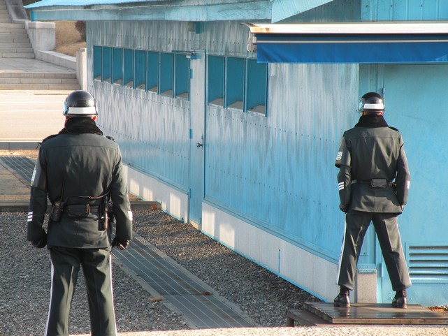
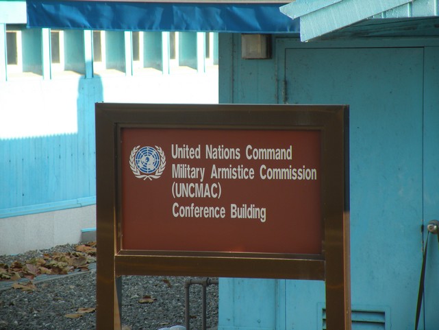
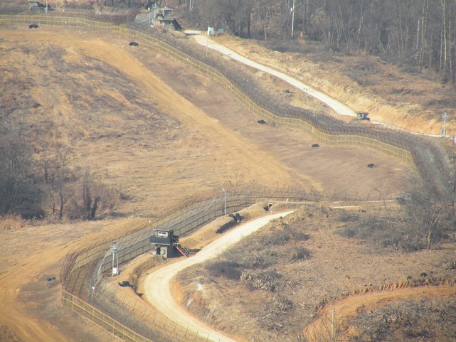
 JSA ist die Abkürzung für Joint Security Area und direkt an der Grenzlinie. Als erstes bekamen wir eine Einführung in die JSA durch einen amerikanischen Soldaten, welcher an der Grenze von Südkorea stationiert ist. Diese Einführung bestand allerdings vorwiegend aus Verboten. Ich bekam bereits vor dem Start der Tour eine ganze Liste mit Kleidungsstücken, welche nicht an der Grenze des JSA getragen werden dürfen. Verboten sind unter anderem Shorts, Jeans mit Löchern, T-Shirts, Flip Flops oder auch Sportkleidung. Südkorea achtet wirklich sehr darauf, dass die nordkoreanische Soldaten keinen Grund finden, um sich provoziert zu fühlen.
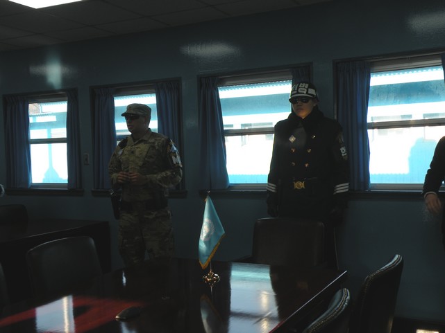
 wäre dafür da um uns zubeschützen. Um ehrlich zu sein hatte mich erst diese Aussage dazu gebracht, überhaupt etwas nervös zuwerden. Aber es unterstrich wirklich auch nochmal die Ernsthaftigkeit der Situation. Trotz allem fühlt es sich irgendwie surreal an. Der arme koreanische Soldat, welcher vor der nordkoreanischen Tür stand, war dann auch für die etwa nächsten 20 Touristenfotos unser Lieblingshintergrundmotiv. Aber er sah auch einfach zu cool aus, mit seiner Sonnenbrille (alle südkoreanischen Soldaten tragen diese Sonnenbrillen – und ja, auch wenn die Sonne nicht scheint).
 des derzeitigen Oberhaupt Nordkoreas Kim Jong-un. Das fand ich wiederum wirklich interessant, da ich gehört habe, dass wenn man Nordkorea besucht man gar nicht selbst das nordkoreanische Geld bekommt, sondern alles in US-Dollar an seinen Guide bezahlt und dieser dann in der Landeswährung für einen bezahlt.





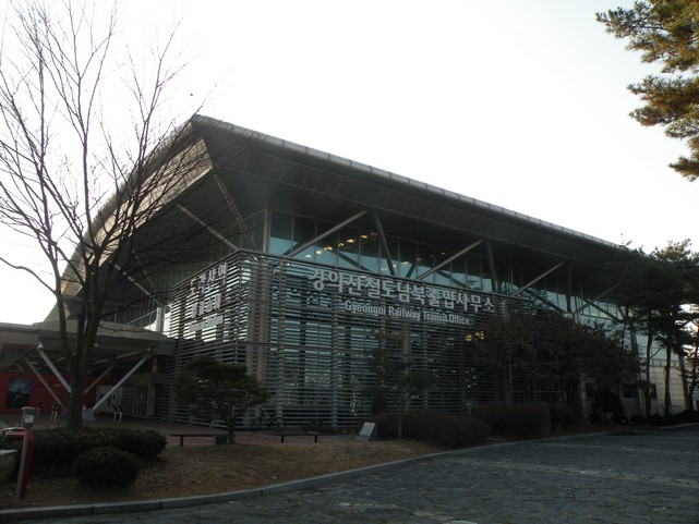
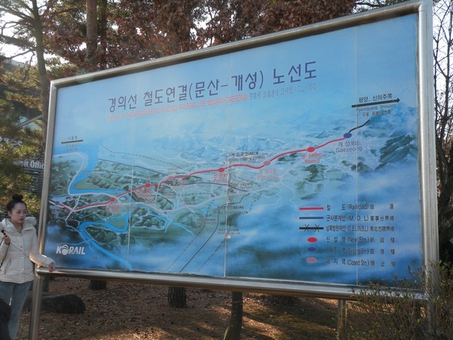
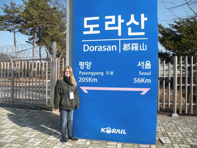
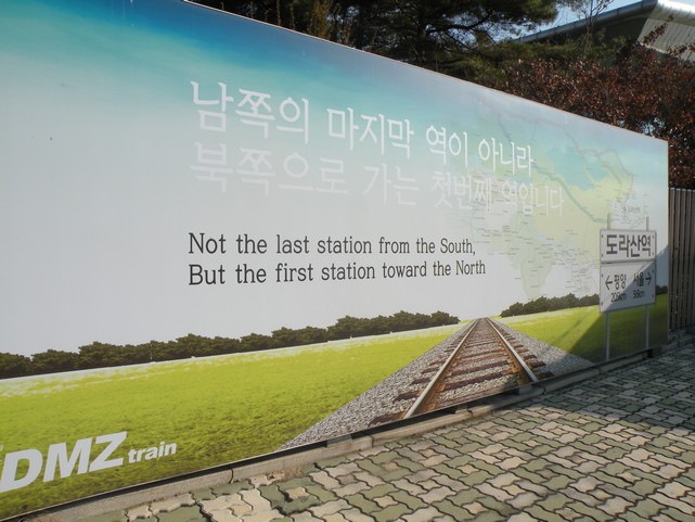
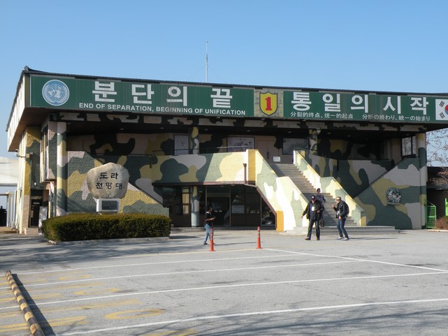
 Unsere Reisegruppe besuchte auch die letzte Zugstation Südkoreas, Dorsan, direkt vor der Grenze. Theoretisch verbindet Dorsan Südkorea mit dem Norden. Praktisch fahren allerdings keine Züge aus dem Bahnhof ab. Aber ein großes Schild in der Eingangshalle sagt „Nach Pjöngjang“. Wir konnten für etwa 80 Cent ein Zugticket kaufen und die Gleise besuchen. Unser Tourguide erzählte uns, dass die Station gebaut wurde, um die beiden Länder im Falle einer Wiedervereinigung miteinander zu verbinden und in diesem Fall auch sofort Züge in Nordkoreas Hauptstadt schicken zu können. Von dieser Station konnten wir auch ganz leise Musik hören, die wohl aus Lautsprechern aus Nordkorea kam.
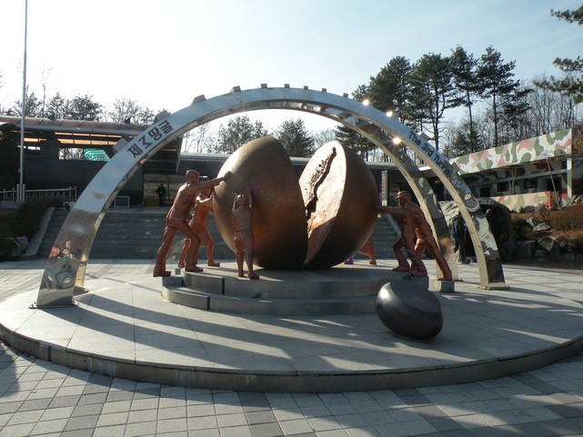
 Die Station Dorsan repräsentiert auch ein Stück Geschichte. Dort steht nämlich ein Teil der Berliner Mauer. Auf beiden Seiten der Mauer sind Tafeln. Die linke zeigt die Daten der deutschen Wiedervereinigung (41 Jahre, 4 Monate und 11 Tage waren Ost- und Westdeutschland getrennt), auf der rechten Seite war eine elektronische Anzeige welche sogar in Sekunden die Dauer der Teilung Koreas hochrechnete. Unser Guide erzählte uns, dass die Zählung sofort gestoppt werden würde, sobald Korea wieder zu einem Land werden würde. Ein kleiner Wagon stellt alte Zeitungsartikel und Fotos von der Wiedervereinigung Deutschlands sowie Relikte von der früheren DDR (Deutsche Demokratische Republik, Ostdeutschland) aus. Die deutsche Wiedervereinigung erinnert die Besucher der Zugstation daran, dass auch eine Vereinigung Koreas immer noch möglich ist.









 Ebenfalls zur DMZ-Tour gehört auch der Besuch des Dritten Tunnels. Dieser Tunnel wurde von Norkorea gemeinsam mit drei weiteren gebaut. Alle vier kreuzen das DMZ von Norden nach Süden. Zunächst bestritt Nordkorea den Bau der Tunnel. Jedoch beweißen die Wände dieser, dass die Erde durch Dynamit von Norden nach Süden abgesprengt worden ist. Der Dritte Tunnel wurde 1978 entdeckt. Südkorea glaubt, dass Nordkorea diese gebaut hat, um möglichst schell Männer im Falle eines weiteren Kriegs nach Südkorea schicken zu können. Es wurde berechnet, dass rund 30.000 Soldaten innerhalb einer Stunde von Nordkorea nach Seoul für einen Überraschungsangriff gelangen könnten. Allerdings wurde der Tunnel niemals fertig gestellt. Die UN beschuldigte Nordkorea des Bruchs der Vereinbarung zum Waffenstillstand zwischen den beiden Ländern.
 Wir bekamen für unseren Besuch gelbe Sicherheitshelme. Zunächst mussten wir entlang einer Rampe in den Tunnel hinuntersteigen. Er liegt etwa 70 Meter unter der Erde und ist an manchen Stellen so niedrig, dass sogar ich beim Laufen den Kopf einziehen musste. Heutzutage werden die Tunnel durch Zementblöcke blockiert. Besucher des Dritten Tunnels können bis zur ersten Blockade vorlaufen und dort durch ein kleines Fenster auf die nächste Wand schauen. Es war ein verrücktes Gefühl durch die unterirdischen, engen Gänge des Tunnelsystems zu laufen und dabei so nah an der Grenze zu sein. Südkorea glaubt, dass es möglicherweise noch deutlich mehr als nur die vier geheimen Tunnel gibt, welche sie bis jetzt gefunden haben.